_____________________________________________________________________________________________________
Showing posts with label Things I do for fun. Show all posts

Sunday, August 22, 2010

In The Kitchen With Stonekettle Station

Today just felt like a soup day.

I mean, some days I just want soup. Now, when I say soup, I’m not talking soup from a can, a box, or a packet. I’m not talking about something you make in 30 seconds or less.  I talking about soup. Soup, real soup takes effort and hours, it’s homemade and full of goodness, liberty, and truth. We’re talking about a hearty soup that is a meal, not something you microwave for lunch and eat with a handful of Fritos.

Soup.

That’s what I’m talking about here.

Soup is something I do particularly well.  I start thinking about it days in advance. Hmmmm I feel soup coming on. Ooooo, what kind? What kind? Maybe broccoli? Or twice baked sour cream potato? Chicken with homemade egg noodles? Clam chowder? 

Today it felt like cheese.

Yep, the more I thought about it, it felt like a cheddar cheese soup day.

Now, there’s an art to making a decent cheddar cheese soup. There are a thousand recipes. Most suck. About half will produce something that strongly resembles the glop rednecks pour over nachos at a tractor pull and most of the rest gives you something that ought to be in a fondue pot or used to waterproof log cabins. Cheddar cheese soup done right has a smooth yet grainy mouthfeel and smells of perfectly aged cheese and freshly risen bread.

Here’s my recipe for Cheddar Cheese Soup.  Do not monkey with this recipe, for it is perfect. I’m warning you. Seriously, the Soup Nazi was a pansy compared to me.


Ingredients
2 tablespoons butter
1 small white onion (diced, about 1 cup)
5 carrots (diced, about 1 cup give or take)
5 big ribs of celery (diced, about 1 cup)
Crimini/Brown Mushrooms (diced, about 1 cup)
1 tablespoon minced garlic

1 pinch of kosher salt

1 bay leaf

3 tablespoons all-purpose flour
2 cups chicken broth

1 bottle Newcastle Brown Ale (Don’t even think about trying to substitute something else. Newcastle or go home and open a can of Campbell’s).

1 cup thick buttermilk

1 teaspoon Worcestershire sauce
1/2 teaspoon white pepper

1 ½ pounds of Tillamook Extra Sharp Cheddar (shredded) (Yes, yes, sigh, if you can’t get Tillamook because you suck, well substitute a very good extra sharp cheddar. Also, you should weep for your misfortune. Personally, I’d move to the west coast, but that’s just me).

Directions
Melt butter in large heavy-bottomed soup pot over medium heat. Add onion, carrot, celery, and salt. Sweat the vegetables for 5 to 10 minutes or until they begin to soften, stirring occasionally. Add mushrooms and garlic, sprinkle the flour over the vegetables, stir, and continue to cook, stirring constantly, for 2 to 3 minutes.

Gradually add the chicken stock and bring to boil, stirring constantly. Reduce heat to low and add the bay leaf. Cover and simmer for 30 minutes or until vegetables are soft.

Remove bay leaf. Remove the bay leaf. Remove the bay leaf.

The following step can be done using an emersion blender, but I don’t have one of those. What I do have is a large countertop blender. Either method works fine, but personally I find the countertop blender easier since it leaves both my hands free to add ingredients. If you use the countertop blender, remove the broth from the heat first and allow it to cool for ten minutes before pouring it into the blender. Whichever method you use, puree the broth and vegetables, leave no chunk unliquefied. Once the broth is smooth, reduce speed and add the buttermilk (slowly), Worcestershire sauce, and the white pepper. Blend thoroughly.

Return to the soup pot and set over low heat.

Take a healthy slug of the Ale and slowly stir the rest into the soup.

Slowly bring the soup up to just below a boil. Let simmer for ten minutes. Stir periodically. Try to resist eating the soup as it is right now. Yes it smells good, but it will be better with the cheese.

Gradually add the cheese, one handful at a time sprinkling over the top of the soup. Then stir until blended before adding next handful. Do this until all the cheese is mixed in. RESIST the urge to add too much cheese at one time.

That’s it.  It’s soup. 

Serve hot with sourdough bread.

Or better yet, serve with crab cake sandwiches.

You’re welcome.


What?

You don’t know how to make crab cakes?

You’re like helpless children here. Seriously.

Fine.

Ingredients:

1lb lump crab meat. Pulled and picked. Canned is fine, but for crying out loud spend a little extra and buy the good stuff which should be mostly claw meat. (Also, turns out you can actually use those artificial crab legs, which are usually made from Haddock, they taste just fine. Be sure to pull the meat apart into small pieces though).

1 egg
¼ cup mayo
1 tablespoon Dijon mustard
1 tablespoon lemon juice
1 teaspoon Old Bay seasoning (don’t skimp, more is better)
¼ cup onion (chopped fine)
2 cloves garlic (chopped fine)
1 cup small dried bread cubes (better yet, use a cup of Stovetop Stuffing, seriously)

Dried breadcrumbs for coating.

Did you say something? Well, speak like you got a pair, I’m half deaf you know.  What? Oh, yes, that. Green peppers. Yes, traditionally crab cake from misguided socialist shitholes such as Maryland have a big old helping of chopped green peppers added.  I hate that. I think the texture of green peppers are all wrong for crab cakes and the taste of the green pepper just takes over.  But if that’s what you want, by all means, toss in a 1/4 cup of chopped green pepper – then go out back and hit yourself in the head with a hammer, it won’t do much for the crab cakes, but it will amuse me and that’s what matters.

Directions

Sweat the onions in a tablespoon of olive oil or butter until cooked through. Cool. 

Break the crabmeat into small pieces, pick through it for shell and gristle bits (remove those, just in case that’s not obvious).  In a large mixing bowl toss together the crabmeat, garlic, and Old Bay until completely mixed.  In a separate bowl beat together the egg, mayo, mustard, and lemon juice until thoroughly mixed. Then add to the crabmeat mixture and blend completely.  Add the bread cubes, mix completely.  Cover and let stand in the fridge for at least an hour.

Divide into six portions (I use a disher for this). Press together and flatten on a plate of bread crumbs, ensuring that each cake is fully coated.  Flatten and shape so that the cakes are a uniform thickness.

Fry carefully in a mixture of hot olive oil and butter, flipping once carefully with a thin flat spatula, until both sides are golden brown and crispy.

Serve on soft rolls with homemade dill/tarragon tarter sauce and a dark bitter green like arugula.

Wednesday, January 20, 2010

Where Was Jim This Weekend? Road Trip!

OK, we didn’t actually go to Mordor.

We went to Chena Hot Springs, about 60 miles or so northeast of Fairbanks.

It was sort of a spur of the moment thing.

What? I hear you say in that tsk tsk tone you reserve for when I’ve done something stupid. You drove nine hours to see some hot water, then turned around and drove nine hours home? Across the arctic tundra? Through a snow storm? At thirty below?

Are you mad?

Could be, Doc, could be.

For about as long as I can remember, my wife has wanted to see the Ice Museum at Chena. Every year we talk about going up there…and never do. Saturday we were discussing what we were going to do this weekend. I and my son had Monday off, my wife didn’t – but she does have a bunch of vacation time saved up.
Take Monday off and let’s go do something, I suggested.

Ice Museum? She said.

Why the hell not, I replied.

We packed the truck with survival equipment, a couple changes of clothes, our cameras, food for a couple of days – and got up early Sunday morning and took off, by the time the sun was up we were a third of the way to Nenana.

Chena Hot Springs 028

Road conditions were about what you’d expect in northern Alaska this time of year:Chena Hot Springs 029

It took us about seven hours to reach Fairbanks – note: this was a spur of the moment road trip, which is why I didn’t get a chance to meet up with any of the Fairbanks contingent of the Stonekettle Station Loyal Readers Association. Apologies, next time for sure.

We fueled up and headed north out of Fairbanks for Chena. Total time inside the Fairbanks city limits? Ten minutes.

Along the way we stopped in at Skunk Place Kennels, home to famous Alaskan sled dog mushers Aliy Zirkle and Alan Moore – who are wonderful people and our friends.

Chena Hot Springs 062

And finally, a couple hours after dark we arrived at Chena.

We didn’t know if they’d have a room (that was part of the adventure, no reservations, ass backward into the unknown – yes, that’s exactly how we travel. You don’t plan road trips). Turns out they did have plenty of rooms – and at half price to boot, January being the seriously off season.

We had a terrific dinner in the main lodge and then put on our arctic gear and took a guided tour of the Ice Museum.

It’s pretty, uh, cool.

Chena Hot Springs 122

The entire place (except for the roof) is carved from giant blocks of ice. Walls, bar, sculptures, chandeliers, furniture, guest rooms, everything. It’s lit with embedded colored lights like some kind of frozen fairyland.

It’s beautiful and well worth the drive.

We had an appletini at the bar, made with Russian vodka that was just this side of liquid nitrogen temperatures and served in a martini glass carved from ice - we ran into the ice sculptor at breakfast the next morning and I learned that those glasses are not cast, but are turned on a lathe.

Chena Hot Springs 108

I also learned that appletini’s are not my drink. Gah.

The caribou fur over the icy bar stool was pretty nice though.

The ice sculptures are amazing. No, really amazing. Seriously.

These jousting knights and their chargers are life-sized, exquisitely detailed, and made without any structural support other than the ice itself. It is an astounding sculpture.

Chena Hot Springs 126

A number of the men admired the artistic merits of this piece:

Chena Hot Springs 081

There were lots of amazing things including these ice globes:

Chena Hot Springs 132 Chena Hot Springs 127 Chena Hot Springs 128

Chena Hot Springs 129 Chena Hot Springs 130 Chena Hot Springs 131

Did you catch up above where I used the phrase guest rooms? Yes, you can spend the night in the Ice Museum, they have a number of nice accommodations:

Chena Hot Springs 097

For about $600 you can bundle up in your complimentary parka and roll up in caribou fur on a big damned block of ice that purports to be a bed. Each room comes fully equipped with modern facilities…

Chena Hot Springs 092

(…and you think your toilet seat is chilly in the middle of the night)

We took a pass on the whole spending the night in the ice hotel thing. I hurt bad enough in the morning without sleeping on a block of ice. They’d probably need the jaws-of-life to get me out of that bed in the morning. It’s been a number of years since I went through arctic survival school and I have no desire to do it again, sleeping on an ice cube at thirty below is more adventure than I need these days.

After the chill of the Ice Palace we spent the rest of the night soaking in the hot springs. And let me tell you something, if you’ve never sprinted barefoot across –20 cement, unclothed except for your bathing suit, on your way from the locker rooms to the hot springs, well you’re just plain missing out. And the trip back is even more exciting – let’s just say that your suit tends to freeze to parts of your anatomy that you’d rather it didn’t and leave it at that. OK? The hot spring was pretty damned nice though.

The next morning we got up early and ate breakfast at the lodge. It was just us and the ice sculptor in the whole place and we had an interesting conversation with her. Very nice lady. Very, very talented sculptor (her and her husband are permanent staff and are solely responsible for creating and maintaining the museum. They compete in ice carving contests the world over).

Then we hit the road and nine hours later we were home again. Along the way we saw some pretty neat stuff - like this, for example, just outside Denali National Park:

Chena Hot Springs 165

and of course, there was that aforementioned glimpse into Mordor…

All in all, a pretty damned fine road trip indeed.


Note: Chena Hot Springs is an interesting place and we wished we would have had more time there – next year we’re going back and spending a couple of days there. The owner has turned the place into a model of alternative and geothermal power generation. People come from all over the world to study the power systems and green houses and the place has been the subject of numerous TV specials. Google Chena Hot Springs or follow the link above to learn more.

Tuesday, May 26, 2009

Eklutna Lake Trail

Well, it’s finally summer here in Alaska.

It doesn’t last long and you really need to taken advantage of what nice days you get.

Saturday we went to see Terminator Salvation in Anchorage (Woohoo! Awesome! More on that later) and then I spent most of the afternoon doing spring maintenance on our ATV’s, figuring that if Sunday was decent we’d get out and do some exploring.

I even demonstrated my optimism by loaded the ATV’s onto the trailer, coupling up the truck and parking the whole rig in the shop in preparation for an early start the next morning.

Sunday dawned clear and beautiful with temperatures in the low 60’s.

So, we loaded our day packs and the rest of our equipment and set out for the Eklutna Glacier Trailhead in Chugach State Park.

ATV 1

(Just for the record, we made the kid ride inside the truck)

The trail starts at the Eklutna Lake State Park camp grounds, and follows the edge of the lake roughly ten miles to the Bold wilderness airstrip. Then the trail continues on, following the Eklutna river another three miles up into a deep valley, a mile or so short of the glacier. If you want to explore the ice, you have to do the last mile on foot over very difficult and dangerous terrain, even rugged 4x4 ATV’s like ours can’t navigate that climb.

The trail itself is an improved jeep trail, though vehicles larger than an ATV are not allowed. Speeds are limited to 15MPH and there is a lot of bicycle and foot traffic so you need to pay attention and observe basic trail courtesy. There are some rough spots, but nothing difficult and it’s an easy trail for a beginner and a good place to refresh your riding skills after the long winter. There are two remote wilderness campsites along the trail, one at 8.8 miles and one at mile 11. There is also a wilderness cabin at mile 12 that you can rent.

The views are spectacular.

Lake Pan 1

Eklutna lake is a seven mile long, deep, fresh water lake that fills a valley carved by the retreating glacier. Several large streams feed into the lake…

ATV 2 ATV 3

…but its primary input comes from the Eklutna River which is in turn fed by glacial melt. Because of this, the lake’s water level can change by as much as sixty feet, depending on season. The Eklutna glacier itself grinds over the bedrock and its weight powders the stone into fine talc, called glacial flour. That flour washes down the river and into the lake, which is what gives the water that otherworldly opalescent milky-blue glow.

ATV 4

You wouldn’t think so, but fish live in the lake, Dolly Varden mostly. They eat bugs and algae and crap cement.

The picture above is the far end of the lake, which we reached in about an hour, then we turned to follow the river towards the glacier, which you can just see nestled in that deep valley in the center of the picture below.

ATV 5

The trail crosses the river several times. The state has built bridges, while this isn’t as exciting a fording a glacially cold, fast moving river on an ATV, it’s a lot safer and more importantly has a lot less impact on the environment. All traffic is limited to the trail and the bridges, this eliminates random damage by idiots on ATVs and prevents erosion (It also has the added side benefit of eliminating most of the idiots, as they think the trail is too tame and they look for adventure elsewhere leaving the traffic here mostly well mannered and well behaved).

ATV 6 ATV 7

Note: You might notice in the upper picture, that my son’s hair is cut short in a high and tight military style. I bribed him into to it. The day before this trip I was so damned sick of that mop he usually sports that I offered to buy him a very nice model rocket - if he’d get his hair cut military style for the summer. He agreed. Bawahahahaha! You have no idea how much this tickles me. Maybe he’ll grow to like it. I told him it makes him look older. Also, chicks dig Marines. He said it was a lot more comfortable inside his helmet. I consider that a promising sign.

Several miles past the lake we came to Serenity Falls.

ATV 8

It doesn’t look like much, but later in the year when the melt is in full gear and the water is really flowing, it’s pretty spectacular.

And finally, we came to the end of the trail, about a mile below the glacier. We ate our lunch and decided not to climb on foot to the ice field itself. It’s pretty treacherous up that way, vertical in some spots, muddy and wet.

And in addition, the bears were out in force.

We could see two black bears stalking mountain goats across the valley, which we watched with binoculars for about an hour.

ATV 10

The goats seemed most unconcerned. I had no doubt that unless the bears were armed with rifles, they weren’t going to be eating goat for dinner. That’s them circled in the picture below. Hard to see in the picture, but hey what do you want? They were damned near a mile away, and a thousand feet up the side of a cliff.

ATV 9

Eventually, one of the bears got tired of the stalk and went off to find better pickings. We watched him cross an ice patch and disappear into the alder scrub. That’s him, that little black dot in the picture below.

ATV 11

On the trail back, we got a much better and much closer view of a black bear.

ATV 12

That’s him, that black blob in the picture above, crossing a stream about 50 yards away. Let me tell you something, getting a picture of a pitch black bear in blinding sun is a royal pain in the ass, especially when he’s moving. Out the ten shots I took, that’s the only one that’s even vaguely bear shaped. He’s a young male, maybe 120 to 160 pounds. We came around a blind corner and caught him in the middle of the road twenty yards ahead of us. My wife and I were on the lead machine, with my son following. I braked hard, and my wife signaled my son to stop. Both my wife and I were armed, me with the large frame .44Mag, and my wife with a .45ACP auto. Either weapon was more than a match a small black bear. We believe in prudence when it comes to Alaskan wildlife however and we have no desire to shoot a bear – well, other than with a camera. We knew there were bears on the trail, the rangers had warned us before we set out, and we’d seen bear scat along the way, and we were prepared for the encounter.

He wanted nothing to do with us, he turned and ran into the woods and I snatched the big camera out of the saddlebag and snapped that shot as he crossed a stream and disappeared into the brush.

A large group of hikers came up the trail then, and another group from the other direction, we warned them about the bear danger and continued on.

River Pan 1

We crossed the final river and hit a muddy patch of the trail. My son had been pestering us the whole way for us to allow him to plow through the water at speed. So when we came to a flooded portion of the trail, we let him have his wish.

Eklutna Glacier Trip 062

He was quite happy with the results.

Eklutna Glacier Trip 063

Until he learned that he would be washing the muddy machines when we got home, that is.

Round trip, we covered just under 30 miles (we took a couple of detours to check out the Bold Airstrip and the campsites). The smaller Arctic Cat performed perfectly, but the big Polaris 700 gave me some grief. It lost power several times and stalled – for all the world like it wasn’t getting gas. I popped off the engine covers, figuring it was a clogged fuel filter, but when I vented the fuel injection bar at the relief value gasoline squired two feet sideways under pressure. Plenty of gas. Probably a wet or dirty electrical connector then. The Cat is fully manual, there’s not much to go wrong with it, but the Polaris is a computerized electronic fuel injected monster, it’s an excellent machine but the more complicated you make them, the more that can go wrong. I carry two full tool kits on each machine, and there’s not much I can’t fix on the trail, and so I fiddled around a bit until I got it running again. Worked fine for the rest of the trip. But if necessary I could have towed it back with the other machine. This afternoon I’ll strip it down in the shop, run the diagnostics, and find the problem.

We were filthy dirty and dead tired by the time we got home. But a hot shower and a hot dinner fixed most of that.

It was a great day.

What adventure did you find this weekend?

Monday, September 22, 2008

Winter in the Pass

Winter's coming folks.

Faster than I like too.

We wanted to get one last hike in before the snow falls, but unfortunately that just wasn't the cards. I've been in a lot of pain this last week and just could not see myself putting on the pack and the shoulder holster and slogging though the mud. Everything hurts, but especially my neck and shoulder. It's been inflamed for a week now, but it's getting better. Nothing particularly unusual for me, the damp and cold always cause me problems. Regardless, the scenery is spectacular this time of year, and we wanted to get out and enjoy it while we can.

So, this Saturday we settled for driving up to one of our favorite places, Hatcher's Pass, to let the dog and the boy play in the snow. Besides, my truck has heated seats and that's almost has good as a heating pad on my back. The road to the pass is still open, but it won't be for much longer, the snow is already down to the three thousand foot mark.

This is a panorama shot looking down from the pass at Government Peak. As always, you can click on the picture and get a higher resolution shot from my Picasa album.


From Stonekettle Station

I put the truck into 4-wheel drive and we bounced through the mud and slush up to the actual pass itself and looked down on Summit Lake. The lake is at about the 4000 foot elevation mark and it was about 35F out. The lake is pretty deep and hasn't cooled down enough yet to freeze over, but it won't be much longer before the ice starts to form.

From Stonekettle Station

On the way back down from the summit, I stopped to take a few pictures and my son climbed up the hill to pick a few late season wild blueberries.

From Stonekettle Station
The hills here are covered in wild low-bush blueberries and a lot of folks come up here with hand sweeps to pick them by the bucket full. Unfortunately this summer we've had torrential rain and very little sunshine. The berries need a lot of sunlight to develop a high sugar content, and this year is just didn't happen, so they're bitter and not that good tasting - or said my wife and son, me personally I don't care much for blueberries and didn't bother trying them.

While my son was roaming the hillside the clouds parted and a shaft of sunlight illuminated the valley floor and I was able to get a nice series of shots:

From Stonekettle Station

Yesterday I was feeling a bit better and was able to wear the shoulder holster for a while. So we took a nice hike through the yellowing foliage along some of our neighborhood trails. Didn't see any bears or moose, though they're about. I also didn't get any pictures, so you'll just have to imagine the deep Alaskan woods in your mind.

Today the pain is better, though I can't turn my head very far. I've got a pile of work in the shop that needs to be done and a couple of errands to run. More later.

So, what did you do with your weekend? I mean besides Jaunt off to Florida and such.

Sunday, August 3, 2008

This week's Alaskan Panorama is...

the Friday Fling - i.e. the Palmer, Alaska Friday market.


Clicking on the photo will take you to a higher resolution version in my Picasa Album. And for a while it's the site banner up there on top of the page.

Beastly is somewhere in this photo, do you see him?

Tuesday, July 29, 2008

Weekend Adventure and more photoshoppery

As I've mentioned, repeatedly, it's been raining here.

A lot.

And it's been cold.

In fact we've got some fresh snow on the mountains.

This does not make me happy, but then again nobody asked me for my opinion.

Anyway, we try to get out on the weekends and do a little hiking. This last weekend rained both days, Saturday it poured cats and dogs, so any kind of outdoor adventure was right out. My wife took one look at it, and decided to go in to work instead - yeah, it was that bad. Beastly and I spent the day in the shop. Sunday was a bit better, drizzling rain, but that appeared to be the best we were going to get - so we decided to take advantage of it. We needed something close to the house, and something short, and preferably a location that we hadn't been to in a long while.

Tbird Fall - bookmark 1


Becky and I thought about for a bit (the kid doesn't get a vote, and neither does Beastly). We thought about the nature trail in Eagle River, the one that leads up into the Chugiach, but there have been a number of bear attacks there lately and I really wasn't interested in that much adventure. Then we hit upon Thunderbird Falls. Little short hike, about a mile and a half, twenty minutes from home - and we hadn't been there in, oh, about ten years. Perfect. Woohoo!

We loaded up the kid, Beastly, the dog, and for good measure I grabbed the day pack and my .44cal Colt (because while Thunderbird Creek is not a salmon spawning stream, there is the occasional stray Humpy or King - and where there's salmon, especially rotting salmon, there are bears).

It was as neat a place as we remembered, and the hike was an easy one up to the viewing deck - which is good because the cold and damp has been making my bones hurt.


It was sprinkling a little, but we had worn our rain jackets, so we decided to hoof down the lower trail to the river itself.


Tbird Falls - roots 1


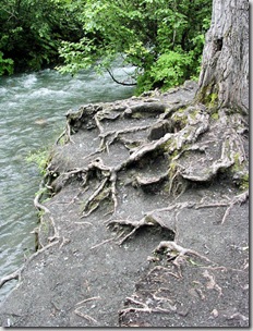
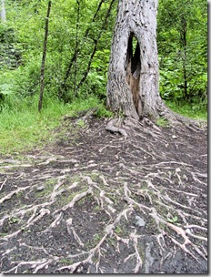
There were some cool trees at the bottom of the trail near the river, erosion had exposed their root system.


Tbird Falls - roots 2


I thought the exposed roots looked strange and alien.


There were a few stray salmon in the river. They looked like a couple of reds, near as I could tell. Salmon normally return to the same stream they were born in, but a few occasionally make a bad turn and find themselves up the wrong creek. (What the? This isn't Pizmo Beach! Maybe I should have turned left at Ahlbecorkee! -[and if you don't get that, I don't want to know you] Consequences, schmonsequences, as long as I'm rich). This is nature's way of propagating the species, the strays sometimes find new spawning grounds - which is funny if you think about it, being as it's the stupid fish that become the progenitors of new salmon runs. Mostly though, the strays end up in places like Thunderbird Creek, dead ending up against the falls in fast water with no place to do the wild thing. They can't spawn and eventually they turn bright red and rotten and then die. In that order.

Salmon in the water

This a fairly good sized female, maybe 15 pounds or so. She's dead, she just doesn't know it yet. No bears around, none that we saw anyway. Which was just fine by me.

I got as close to the base of the falls as I could and took a series of sweeping photos down the river. Panoramas, it's my new thing.

Thunderbird Falls - Panorama

Clicking on the image will take you to a full-sized, hi-resolution image in my Picasa album.

Tuesday, July 15, 2008

Hatcher's Pass - Reed Creek Trail

After two weeks of rain, this last weekend was reasonable decent.

I was getting shop fever, and wanted to get the hell out and do some hiking in the wilds of Alaska. Fortunately for us, the wilds of Alaska are pretty much right outside the front door. So, we loaded up Beastly, the rain jackets, the daypacks, and the dog and headed up to Hatcher's Pass to try our hiking boots on the mud of the Reed Creek trail. Which leads, naturally enough, up into Reed Valley and to the old Archangel Gold Mine. Follow it far enough, and it will take you up over the mountains and a high glacier and eventually to the wreck of an old WWII bomber that crashed during the war. Twelve Airmen died in that crash. The Army long since removed the bodies, but there was no way to get the massive carcass of that old B-29 out of the mountains, and so it's still up there - a destination for hikers and geocachers and war buffs.

We got a late start and the weather wasn't great, so we didn't figure on making the crash site. We planned to reach the upper end of the valley above the old mine - a distance of about five miles in, and the same route back out. Ten miles would really be pushing it, but what the hell, we weren't in a hurry and it's daylight pretty much 24-hours a day this time of year.

The limiting factor would, of course, be Beastly and me. Both of us are in pretty good shape considering twenty years of military service a piece and various old, poorly healed injuries. Beastly's got problems with a repeatedly broken ankle, and I've got problems with my whole left side. So we figured to make it as far as we could and turn back before we crippled ourselves. I wasn't sure we'd even make the mine site, a lot depended on trail conditions - which could be pretty ugly after two weeks of rain - but hell, we figured we'd give it a shot.

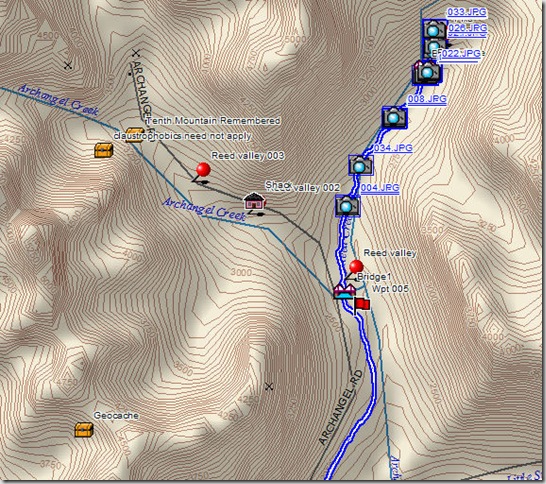
Then we got a break, when we reached the Archangel road parking area, the road gate was open. Normally, the Bureau of Land Management (the whole area is BLM land) keeps the road closed. You park out on the main road and walk in. But every once in a while they open the old mine road and let you drive in about two miles to the actual trail heads for Archangel Valley and Reed Creek. Woohoo! That knocked about four miles off the trip, and we figured we could do the remaining six easy enough.

Archangel Reed Lake Trail Map

The road was pretty rough, but we made to the trail head without problems, bouncing along in the truck. We parked at the old fire bridge (Bridge 1 marker on the map above) and geared up. There were quite a few folks at the trailhead, including a troop of boy scouts from somewhere in Pennsylvania, loaded down with ice climbing gear and intent on exploring the glacier and reaching the crash site.

The Reed Creek Trail looked good from the parking area, surprisingly dry and in decent shape, considering that three weeks ago this whole area was covered in snow and mud. We slathered ourselves in bug dope and headed down the trail into the valley.

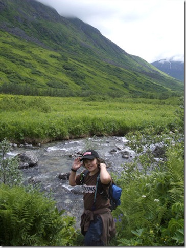
Reed Creek 1

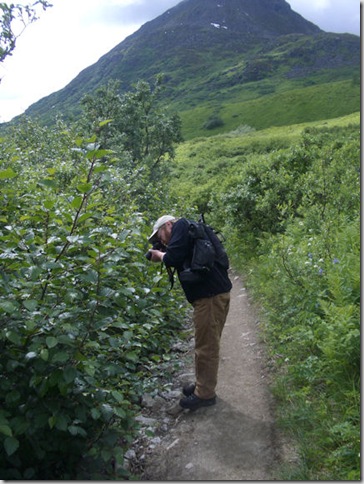
Beastly, who is an avid photographer, kept stopping to take pictures of the flowers.

Reed Creek 2

After exactly two miles, according to the GPS, we emerged from the heavy foliage along the creek and could see the old mine buildings ahead.

Reed Creek 3

That's the mine, that little silver rectangle to the right and middle of the above picture.

It took about twenty minutes to reach the mine site, which is pretty overgrown. You've got to be extremely careful poking around off the trail. There's cables and pipes and rusty equipment scattered about, and it would be easy to fall into an open pit or old foundation if you're not paying attention.

Reed Creek 4

The valley is pretty damned remote, and while it's a beautiful and pleasant place this time of year, try to imagine living here in a mining camp in deep winter when the snow is fifteen feet deep and the winds are howling down off the glacier and the temperature rarely climbs above -40F. Now try to imagine doing that in the first decades of the last century (these mines operated up until the beginning of WWII or so) when all your supplies were packed in through the mountains on mule trains or primitive 4-wheel drive trucks. There are no trees up in these alpine valleys, heat came from coal fired stoves and the coal had to be packed in. Same for food and supplies. Some of the miners lived up here for years. No phones and only intermittent radio communications. No medical help. Hearty souls, those old miners.

Behind the mine the valley ends in a wall four thousand feet high. Above that is the glacier and the wreck site.

Reed Creek 5

We figured we'd climb to the waterfall, which is about twelve hundred feet up a very steep trail. You can just the waterfall as a silver spot in the upper left, just above Beastly's head, in the below picture.

Reed Creek 6

Above five hundred feet up, Beastly decided he'd gone far enough. His ankle was giving him grief and he didn't want to aggravate it any further. I heartily agreed as I had no desire to carry his big ass all the way back to the truck.

So we left him.

Actually Beastly mooched back down the trail to the mine, happily taking pictures, and we headed up the mountain. Now before anybody takes me to task for leaving a member of the hiking party alone on the trail, don't worry, we could both see each other from our respective positions. Beastly knows not to wander off the trail into the bush and to stay in the mining camp. Plus, there was a whole troop of Boy Scouts around if he needed help crossing the road or needed a beer or something.

We made it to waterfall in about twenty minutes.

Reed Creek 7

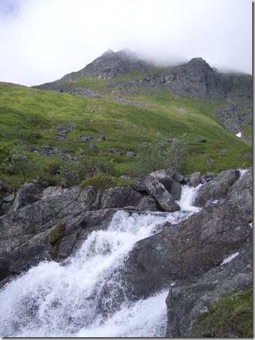
It doesn't look like much in the picture, but it's pretty dammed impressive in person. That water is falling from three thousand feet up, and it's moving. It's also cold as hell and temperatures in the area were a good ten degrees below the surrounding ambient because of it.

The view of the valley was spectacular.

Reed Valley Panorama 1

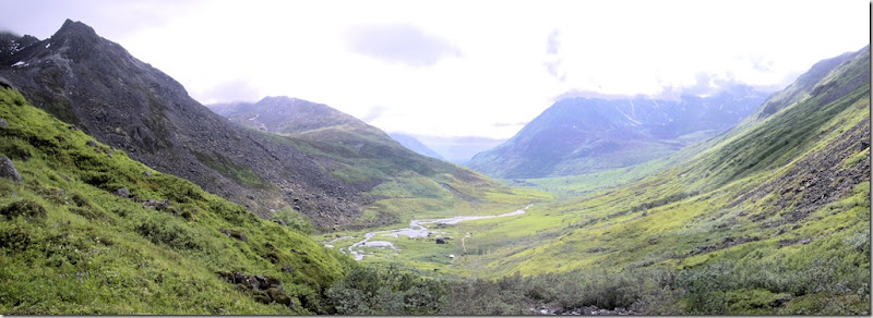
The above panorama was stitched together from three shots taken with my Pentax S4 digital. What a great little camera. I put the camera in panorama mode and snapped three shots using the pan alignment function. I stitched them together using Corel's Paint Shop X2 layering function and I think it came out rather well.

We headed back down the mountain, picked Beastly up from the mining camp, and followed the trail back the truck. Round trip just under six miles according to my GPS.

All in all, a pretty good day.